

North Branch Trail
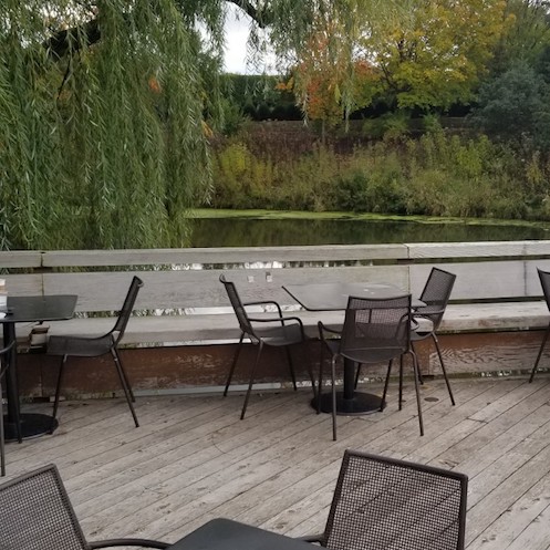
The North Branch Trail, which extends about 20 miles mainly along the banks of the North Branch of the Chicago River from northwest Chicago to just south of the Chicago Botanic Garden in Glencoe, Illinois is an oasis from adjacent urban and suburban landscapes. Here one can observe deer and many species of birds and flowers in a wooded bucolic setting while hiking, jogging, running or bicycle riding. Boating, fishing, horseback riding and picnicking are also options, and cross-country skiing is possible in winter. The Skokie Lagoons which extend from Willow Road north to Dundee Road are particularly picturesque. The main trail is paved, and there are additional unpaved trails and bridal paths.


Details
Managed By
Distance from Downtown Chicago
About 10 miles from the center of town to the southern end of the trail at Irene C. Hernandez Family Picnic Grove and about 22 miles to Forest Way Picnic Grove #1 near the northern end of the trail
How To Get There
Accessibility
There are accessible parking spaces. Tower Road Boat Launch in the Skokie Lagoons provides an accessible trailered boat launch and accessible fishing. Accessible picnic groves are located at Blue Star Memorial Woods, Bunker Hill, Forest Glen Woods, Harms Woods-North, Irene C. Hernandez Family Picnic Grove, and LaBagh Woods. These may be reserved online here.
Things To Do
Biking, Birdwatching (canvasbacks, cuckoos, flycatchers, gulls, loons, thrushes, vireos, warblers), Boating, Cross-Country Skiing, Fishing, Hiking, Horseback Riding, Jogging, Picnicking (consult here for a list of accessible picnic shelters), Running, Watchable Wildlife (deer can often be spotted early in the day) and Wildflowers.
Fun Facts
The Skokie Lagoons near the northern end of the trail were the site during the 1950’s of a Nike anti-ballistic missile base.
Other Information
There are numerous parking areas, restrooms and water pumps along the trail.
ONE-WAY BIKING/HIKING OPTIONS WITH MASS TRANSIT: Take the Union Pacific Northwest Line train in the direction of Harvard from Ogilvie Transportation Center or from the Clybourn Metra station and get off at Norwood Park which is about a mile from the Caldwell Woods entrance to the trail. Ride north to the end of the trail and through the Chicago Botanic Garden and take the connector trail (about 1.4 miles) to the Greenbay Trail. The connector trail ends just south of the Braeside Metra station where trains run back to Clybourn and the Ogilvie Transportation Center. Travel through the Botanic Garden is only permitted during the hours that the garden is open to public which are generally 8 to dark. This itinerary can also be done in reverse. Please consult the Overview section for more information on transporting bicycles on mass transit.
Eats
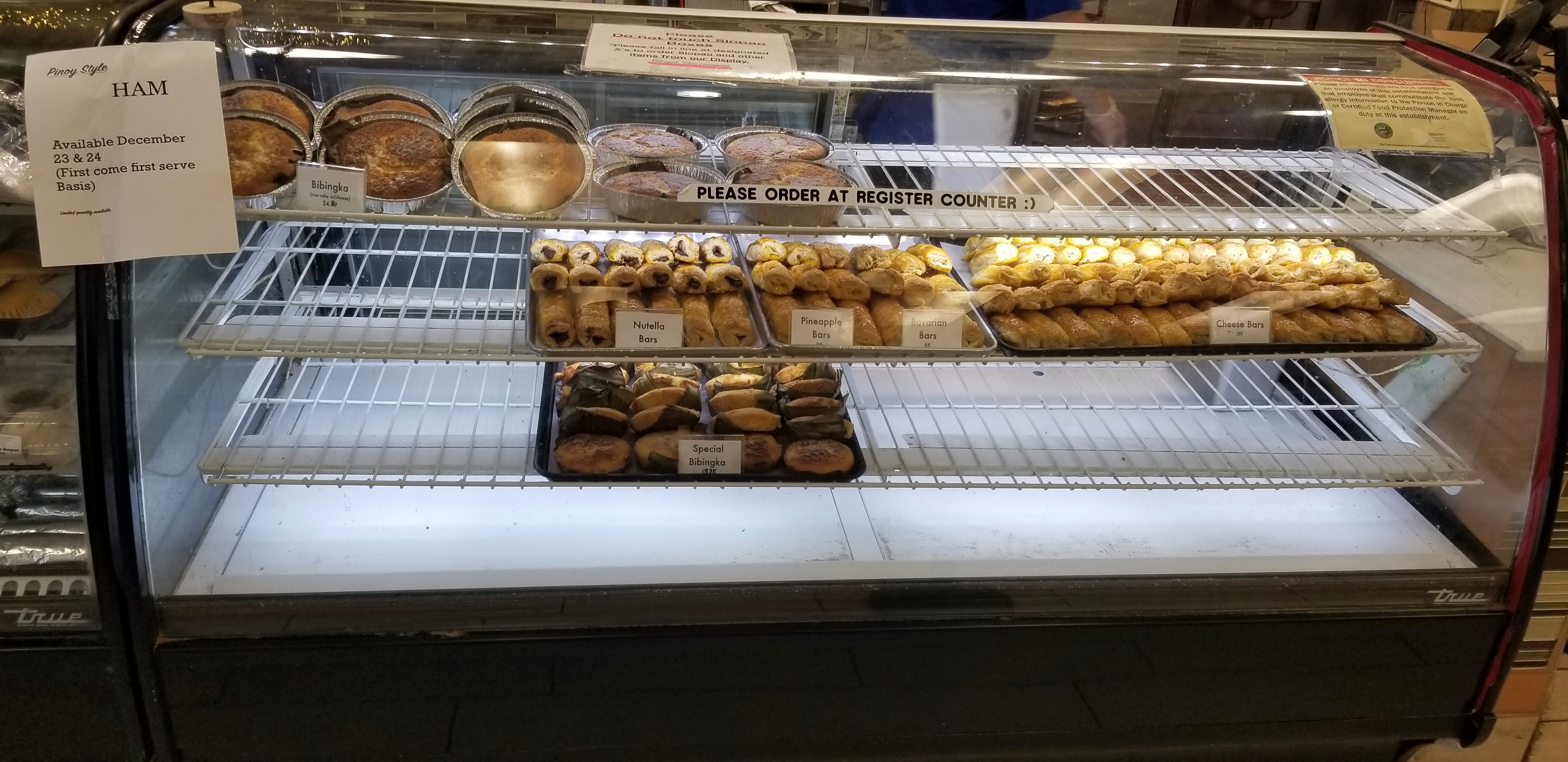
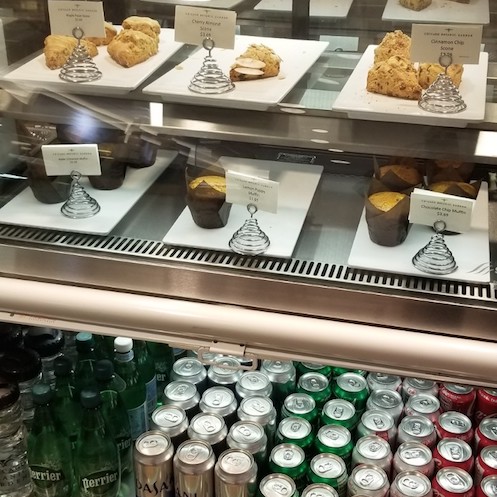
A good takeout option near the Irene C. Hernandez Picnic Grove at the southern end of the trail is Valerio’s Tropical Bakeshop, a Filipino bakery featuring sweets and empanadas, located at 5033 North Elston Avenue, Chicago. The Chicago Botanic Garden at the north end of the trail has a cafe.
Nearby Public Lands Worth Visiting
Chicago Botanic Garden which is described on this website and has an entrance just for pedestrians and bicycle riders on Dundee Road across the street from the northern end of the trail.
Best Time To Visit
All year
© 2021 50 Great Public Land Destinations - Chicago and Beyond. All Rights Reserved.